NATIONAL TRAIL Two-way trail guide - Chipping Campden to Bath
Guidebook to walking the Cotswold Way National Trail between Chipping Campden and Bath, across the Cotswolds AONB - which includes both a guide to the route and a separate mapping booklet. The 102 mile (163km) route is described in both directions over 14 stages, of between 4 and 10 miles, depending on the existence of overnight accommodation. ......
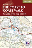
Complete 1:25,000 OS Maps for the National Trail route
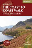
A booklet of all the mapping needed to complete the Coast to Coast Path National Trail, originally conceived by Alfred Wainwright. Suited to experienced walkers, the 317km (197 mile) C2C passes through the Lake District, Yorkshire Dales and North York Moors to link St Bees on the west coast with Robin Hood's Bay on the east. The full ......
All the mapping you need to complete the 185-mile (296km) unwaymarked Coast to Coast Walk from St Bees in Cumbria to Robin Hoods Bay, North Yorkshire. Devised by Alfred Wainwright and now a firm favourite among long-distance walkers, it typically takes a fortnight to complete, and is suitable for most fit walkers. This booklet of Ordnance ......
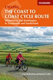
Whitehaven or Workington to Tynemouth or Sunderland
Guidebook to cycling the Sustrans Coast to Coast Cycle Route across the north of England, from Whitehaven or Workington to Newcastle or Sunderland, passing through the northern Lake District, the Pennines and County Durham. The 140 mile route is presented in 3 stages, with alternative start and finish stages, and is suitable for all bikes.
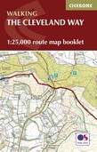
All the mapping you need to complete the Cleveland Way national trail. A long-distance route of 177 km (110 miles), giving around 9 days of easy and enjoyable walking through the North York Moors National Park, taking in open heather moorlands, gentle dales, interesting towns and villages, and dramatic cliff coastlines. This booklet of Ordnance ......
Map booklet of the Cleveland Way National Trail, a 177km (110 mile) walk around the North York Moors National Park. This booklet is included with the Cicerone guidebook to the Cleveland Way and the Yorkshire Wolds Way, and shows the full route of the Cleveland Way on Ordnance Survey 1:25,000 maps
NATIONAL TRAILS: The North York Moors, Yorkshire Wolds and Yorkshire Coast
Guidebook to the Cleveland Way and Yorkshire Wolds Way National Trails, plus the Tabular Hills Walk link route. The guidebook also contains a 1:25,000 scale OS route map booklet of the Cleveland Way. The Cleveland Way National Trail, described in seven day stages, is a fine 177km (110 miles) walk around the North York Moors National Park from ......
From Lisbon and Porto to Santiago - Central, Coastal and Spiritual Caminos
The Portuguese Way (Camino Portugues) is a 620km long-distance route from Portugal's capital Lisbon to Santiago de Compostela in Spain. This guide splits the route into 25 stages, with two coastal options, and takes in historic and religious sites and stunning scenery. With information on preparation, planning and accommodation.