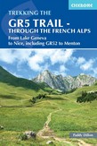
From Lake Geneva to Nice, including GR52 to Menton
A guidebook to trekking the GR5 from Lac Leman (Lake Geneva) through the French Alps to the Mediterranean at Nice or Menton. Covering 685km (426 miles), this long-distance trek through the Vanoise, Queyras and Mercantour National Parks takes around 1 month to hike and is suitable for alpine trekkers with a good fitness level. The route ......
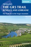
The North Sea to Schirmeck in the Vosges mountains
Guidebook to walking the northern section of the GR5 - 1000km starting in Hoek van Holland and passing through the Netherlands, Belgium, Luxembourg and Lorraine to Schirmeck in France. A long-distance route covering a variety of cultures and landscapes. The full GR5 from the North Sea to the Mediterranean is one of the world's greatest trails.
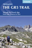
An essential guidebook for walking the GR5 trail, 660km from Lac Leman (Lake Geneva) to Nice or Menton, through the French Alps. Includes all the main variant routes as it passes Mont Blanc, then through the Vanoise, the Queyras and the Mercantour National Parks. Includes accommodation, profiles and maps. Suitable for fairly experienced hikers.
Guidebook to the Elbe cycle route through Czechia and Germany. This 1232km route along one of Europe's great rivers follows the Elbe from its source to the North Sea coast, visiting Prague, Dresden, Magdeburg and Hamburg. 29 stages of easy, flat cycling mainly on quiet country roads and dedicated cycle tracks.
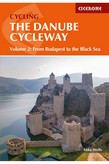
Cycling guidebook to the Danube Cycleway exploring the route from Budapest to the Black Sea, the more adventurous second part of the Danube, suitable for most abilities and bike types. The river route starts in Hungary and continues into Croatia and Serbia before ending at Tulcea in Romania. The Danube Cycleway is also part of EuroVelo 6 (EV6).
From the source in the Black Forest to Budapest on EuroVelo 6
This guide describes the first 1269km of the cycle route that follows the Danube river from its source in the Black Forest to Budapest. Leading through Germany, Austria, Slovakia and Hungary, the route visits spectacular gorges, hilltop castles, vineyard-clad hillsides and medieval towns. The route mostly follows part of the EuroVelo ......
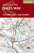
Map of the 79 mile (127km) Dales Way through the Yorkshire Dales between Ilkley and Bowness-on-Windermere. This booklet is included with the Cicerone guidebook and shows the full route on OS 1:25K maps. One of the most gentle multi-day walks in Britain, it passes through Grassington, Kettlewell, Dent, Sedbergh and Staveley.
All the mapping you need to complete the Cotswold Way National Trail between Chipping Campden and Bath. NOTE: An accompanying Cicerone guidebook - The Cotswold Way - describes the full route in both directions with lots of other practical and historical information, for those who prefer a written guide. The accompanying guidebook INCLUDES a copy ......
Map of the 102 mile (163km) Cotswold Way National Trail, between Chipping Camden and Bath. This booklet is included with the Cicerone guidebook to the trail, and shows the full route on Ordnance Survey 1:25,000 maps. The trail typically takes a fortnight to walk, and is suitable for walkers at all levels of experience.